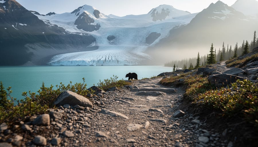
Kluane National Park and Reserve sprawls across 22,000 square kilometers of southwestern Yukon, harboring Canada’s highest peaks, the world’s largest non-polar icefields, and a wilderness so vast that grizzlies outnumber visitors on most trails. If you’re exploring British Columbia destinations and seeking true alpine remoteness, this UNESCO World Heritage Site offers something rarely found elsewhere: landscapes where human presence feels genuinely secondary to the ancient rhythms of glaciers, dall sheep migrations, and the stories of the Southern Tutchone people who have called these valleys home for millennia.
Located along the Alaska Highway near Haines Junction, roughly 160 kilometers west of Whitehorse, Kluane presents a paradox for trip planners. The park’s accessibility has improved significantly, with wheelchair-accessible facilities now available at Kathleen Lake and both visitor reception centres, yet its backcountry remains uncompromisingly wild. Most of the reserve lies locked beneath ice, accessible only to mountaineers attempting giants like Mount Logan. For the majority of visitors, the experience centers on day hikes through subalpine meadows, paddling turquoise glacial lakes, and watching for wildlife along corridors where the mountains meet the boreal forest.
The Champagne and Aalseni First Nations have shaped these lands through careful stewardship long before park boundaries existed, and their partnership in managing Kluane today ensures that conservation extends beyond protecting scenery to honoring the cultural relationships that sustain this ecosystem. Understanding that heritage transforms a visit from sightseeing into something deeper.
A Living Landscape: Understanding Kluane’s Geography and Ecology
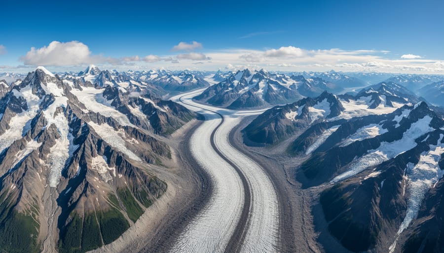
Kluane exists on a scale that defies easy comprehension. Spanning 22,013 square kilometers in Canada’s southwest Yukon, the park protects a landscape where ice reigns supreme and peaks scrape the upper atmosphere. This isn’t wilderness you can grasp from a roadside pullout, roughly 80% of Kluane lies buried under massive icefields, creating the largest non-polar ice mass on Earth outside Antarctica and Greenland.
The St. Elias Mountains form the park’s backbone, a young and still-rising range where tectonic forces continue to push rock skyward. Mount Logan dominates this icy realm at 5,959 meters, claiming the title of Canada’s highest peak and the second-highest in North America. But Logan doesn’t stand alone, seventeen of Canada’s twenty highest peaks thrust up from Kluane’s icefields, creating a fortress of granite and ice that has shaped the region’s ecology for millennia.
What makes this landscape remarkable isn’t just its size or height. The park encompasses a complete cross-section of northwestern mountain ecosystems, layered like a vertical textbook. At valley floors near the Alaska Highway, boreal forests of white spruce and trembling aspen shelter moose and bears. Climb higher and you’ll enter subalpine zones where stunted trees give way to wildflower meadows. Push further still and you reach alpine tundra, where only the hardiest lichens, mosses, and cushion plants survive the thin air and harsh winds. Above 2,500 meters, life yields entirely to rock and ice.
This ecological richness earned Kluane its UNESCO World Heritage designation in 1979, later expanded to include adjacent protected areas in Alaska. The designation recognizes not just the superlative scale but the intact nature of these ecosystems, predator-prey relationships function here as they have for thousands of years, with grizzly bears, wolves, and golden eagles hunting across vast territories. The icefields themselves serve as frozen libraries, their layers recording centuries of climate history and supporting unique ice-edge ecosystems where glacial meltwater feeds networks of lakes and rivers.
The park’s western boundary follows the divide where Pacific weather systems dump moisture before crossing into interior valleys, creating dramatic weather contrasts and feeding the very glaciers that define Kluane’s character.
Indigenous Roots: The Southern Tutchone and Champagne Aishihik First Nations
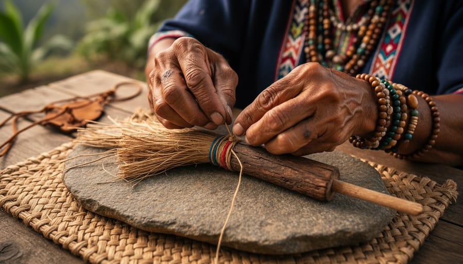
The Southern Tutchone people have lived in what is now called Kluane National Park and Reserve for more than 8,000 years. Their relationship with this land runs deeper than ownership or management. It’s a living connection woven through language, stories, and seasonal rhythms that continue today.
The name Kluane itself comes from the Southern Tutchone word Lù’àn Mân or Lù’àn Män, meaning “lake with many fish.” This refers to Kluane Lake, the largest lake in Yukon, where families traditionally gathered for fishing camps each summer. Place names across the region tell stories: Thechàl Dhâl (Slim’s River) speaks to the river’s character, while Tachäl Dhâl translates as “hammer stone creek,” marking where people found materials for tools.
One story passed down through generations tells of a giant glacial lake that once filled the valleys. When the ice dam finally burst, it carved the landscape visitors see today. This isn’t just legend. Geological evidence confirms massive glacial outburst floods shaped these valleys, showing how traditional knowledge and Western science often arrive at the same truths through different paths.
The Champagne and Aishihik First Nations signed their land claims agreement in 1993, becoming one of the first Yukon First Nations to achieve self-governance. This agreement fundamentally changed how Kluane is managed. Parks Canada now works in genuine partnership with First Nations, co-managing the reserve through a shared decision-making framework. It’s not consultation as an afterthought. Indigenous knowledge guides wildlife management, visitor education, and conservation priorities.
You’ll see this partnership reflected in the visitor centres, where Southern Tutchone names appear alongside English, and where exhibits explain traditional hunting territories and seasonal camps. The closed captioned cultural history video available at the Haines Junction visitor centre shares stories told by community elders themselves. Rangers often include indigenous perspectives in their interpretive programs, connecting Indigenous history to the mountains and icefields visitors come to see.
Contemporary Southern Tutchone people aren’t frozen in the past. They run businesses in Haines Junction and Burwash Landing, guide visitors through their ancestral territory, and advocate for climate action as they watch glaciers they’ve known their whole lives retreating year by year. When you visit Kluane, you’re traveling through someone’s backyard, someone’s history, someone’s present. That matters.
Planning Your Visit: Access, Facilities, and What to Expect
Kathleen Lake: Your Gateway to Kluane
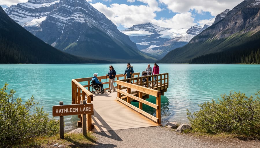
Kathleen Lake sits roughly 27 kilometres south of Haines Junction along the Haines Road, where turquoise water meets mountain slopes that climb straight into alpine territory. This is where most visitors begin their Kluane experience, and for good reason: it’s the park’s most developed area, with facilities designed for everyone from families to travelers with mobility considerations.
The campground offers 41 sites tucked into boreal forest, two of which have adjacent wheelchair-accessible outhouses. At the day use area, you’ll find accessible picnic tables, shelters, interpretive panels, and outhouses, all designed to let you settle in and take your time absorbing the view. The Kokanee Trail boardwalk runs along the lakeshore from here, providing a level, wheelchair-accessible path where the scenery does the heavy lifting: mountains reflected in still water, the occasional loon call echoing across the surface.
What makes Kathleen Lake ideal for first-time visitors isn’t just the infrastructure. It’s that you get a genuine taste of Kluane’s character without committing to backcountry navigation or glacier flights. The scale is human here, you can walk to the water’s edge, watch for wildlife along the shoreline, and understand why this landscape earned its UNESCO designation, all while knowing your vehicle and camp are close by. For those testing their comfort level in remote wilderness or working within physical limitations, it’s a manageable entry point that still delivers the essential Kluane experience.
What You Can and Can’t Expect
Kluane isn’t a park where you’ll find paved paths every hundred meters or cell signal when you need directions. This is genuine wilderness: most of the 22,000 square kilometers remains roadless, and the handful of maintained trails barely scratch the surface. The visitor centres in Haines Junction provide excellent orientation, but once you leave Kathleen Lake’s developed area, you’re largely on your own.
Cell service is sporadic to nonexistent throughout most of the park. GPS devices work, but don’t expect to Google trail conditions mid-hike or text for help from a backcountry camp. Weather shifts rapidly, mountain conditions can turn dangerous in hours, even during summer months.
Before you arrive, verify current details directly with Parks Canada: entry fees change, seasonal road access varies with snowmelt and weather, and backcountry permits may have quota systems that weren’t in place the previous year. The Alaska Highway stays open year-round, but internal park roads and facilities operate on seasonal schedules that shift based on conditions rather than fixed calendar dates.
This isn’t a criticism, it’s Kluane’s appeal. You’re visiting one of Earth’s largest non-polar icefields, not a curated outdoor museum. Come prepared for self-sufficiency, accept that plans may need to flex, and you’ll find the remoteness exhilarating rather than frustrating.
Adventures in the Icefields: Activities and Experiences
Flightseeing: The Only Way to See Most of the Park
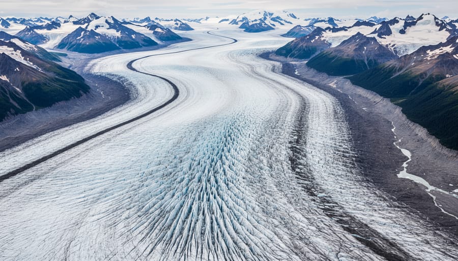
Standing at Kathleen Lake, you’re seeing perhaps five percent of Kluane. The rest, the crushing scale of the icefields, the amphitheaters of rock and ice where Mount Logan rises above everything else in Canada, the glaciers that dwarf city blocks, lies beyond what any trail can reach. This isn’t a marketing pitch. It’s geography. Roughly 80 percent of the park is locked under ice, accessible only from the air.
Flightseeing tours launch from Haines Junction, typically flying over the Lowell Glacier and into the heart of the St. Elias Range. Through the aircraft window, you’ll watch rivers of ice carve through mountains, see crevasses split blue-white in the sun, and understand why the Southern Tutchone called this place Lù’àn Mân Ku Dän, “place of many fish”, referring to the valleys, not the frozen heights above. The flights aren’t cheap, but they answer the question most ground-bound visitors carry: what does this place actually look like? Without wings, you’ll never know.
Hiking and Backcountry Trekking
Kluane’s hiking ranges from gentle lakeshore walks to serious backcountry expeditions that demand wilderness expertise. The Kokanee Trail at Kathleen Lake offers an accessible introduction, but venture beyond developed areas and you’re entering remote terrain where self-reliance isn’t optional, it’s survival.
Day hikes near the Alaska Highway provide manageable routes with spectacular views, though even these require proper footwear, layered clothing, and bear awareness. Most trails are unmarked or minimally maintained, so bring detailed maps and know how to use them. Weather shifts fast here; what starts as sunshine can become whiteout conditions within an hour.
Backcountry trekking is expert-level wilderness travel. You’ll navigate without trail markers, ford glacial streams, and potentially go days without encountering another person. GPS devices, satellite communicators, and topographic navigation skills are essential, not suggested. River crossings can be life-threatening during afternoon melt, and route-finding through dense brush tests even experienced hikers.
Bear safety permeates every backcountry decision. Carry bear spray within reach, store food in bear canisters, and make noise constantly. This is grizzly country, and you’re sharing their home. The park requires backcountry registration for overnight trips; check current requirements with Parks Canada before you go.
Wildlife and Wilderness Safety: Sharing the Land Respectfully
Wilderness travel in Kluane means sharing space with grizzly bears, Dall sheep, moose, caribou, and countless other creatures who call this land home long before Parks Canada drew boundaries on maps. The Southern Tutchone peoples have lived alongside these animals for thousands of years, developing a relationship based on respect, awareness, and understanding that humans are visitors in wildlife’s territory. This perspective should guide every step you take in the park: you are entering the home of apex predators, and your responsibility is to move through their space without creating conflict or danger for either party.
Grizzly bears command the most attention in Kluane’s backcountry, and rightfully so. These powerful animals are common throughout the park, foraging on berries, roots, and occasionally hunting larger prey. Make noise as you hike, especially near running water, blind corners, or dense vegetation where sight lines are limited. Travel in groups of three or more, which statistically reduces bear encounters. If you spot a bear, give it wide berth, at least 100 metres, and never position yourself between a sow and her cubs or a bear and its food source.
At both visitor centres, you can watch the closed-captioned “Staying Safe in Bear Country” video, which demonstrates proper response techniques for different encounter scenarios. If a bear approaches, stand your ground, speak in a calm, low voice, and prepare your bear spray. Never run, you cannot outrun a grizzly, and running triggers chase instincts. Back away slowly if the bear is not approaching. In the rare event of a defensive attack, playing dead may stop the encounter; in predatory situations, fight back aggressively.
Proper food storage is non-negotiable. Use approved bear canisters for overnight trips, hang food where cable systems exist, and cook away from your sleeping area. Clean dishes thoroughly and pack out all garbage. Even seemingly innocuous items like toothpaste, sunscreen, and lip balm carry scents that attract wildlife.
Trail etiquette extends beyond bear safety. Give all wildlife space to move away from you. Never feed animals or leave food scraps, which habituates wildlife to human presence and ultimately leads to dangerous encounters or animal removal. Respect closed areas, which often protect denning sites or sensitive habitat. The land provides everything these animals need; your role is simply to pass through without disruption, honouring the indigenous understanding that humans and wildlife can coexist when humans exercise humility and care.
Sustainable Travel in Kluane: Leave No Trace Principles
Kluane’s glaciers are retreating. The St. Elias icefields that define this park are shrinking as global temperatures rise, making every visitor’s impact matter more than ever. Practicing responsible tourism here isn’t just good etiquette, it’s essential to preserving what makes this wilderness extraordinary.
Start with the Leave No Trace basics: pack out everything you pack in, stay on designated trails where they exist, and camp only in established sites or on durable surfaces. In Kluane’s fragile alpine and tundra zones, a single footprint can damage vegetation that takes decades to recover. Avoid trampling plants, cutting across switchbacks, or creating new paths.
Human waste requires careful attention in this remote environment. Bury it at least 15 centimeters deep and 70 meters from water sources, trails, and campsites. Pack out toilet paper and hygiene products, nothing degrades quickly in these cold temperatures.
The Southern Tutchone have stewarded this land for thousands of years through principles that align perfectly with modern sustainability: take only what you need, leave the land as you found it, and recognize your place within the ecosystem rather than separate from it. Showing appreciation for Kluane means acknowledging this indigenous wisdom and applying it.
Keep wildlife wild by storing food properly in bear canisters and never approaching animals for photos. The grizzlies, Dall sheep, and caribou you encounter depend on maintaining their natural behaviors, which human interference disrupts.
Finally, consider your carbon footprint getting here. Kluane’s icefields are climate change indicators visible from the air, shrinking year by year. Offset your travel emissions where possible, carpool along the Alaska Highway, and extend your stay to justify the journey’s environmental cost.
Common Questions About Visiting Kluane National Park
When is the best time to visit Kluane National Park?
Summer months from June through August offer the most accessible conditions, with longer daylight hours and open trails, though weather remains unpredictable even in peak season. Winter visits are possible for experienced cold-weather adventurers but require specialized preparation and equipment.
Do I need a guide to explore Kluane?
While day hiking accessible trails like the Kokanee boardwalk at Kathleen Lake doesn’t require a guide, backcountry trekking and glacier travel demand either expert-level wilderness navigation skills or a professional guide. Flightseeing tours operate with licensed pilots who provide interpretation of the landscape.
How much time should I allocate for a Kluane visit?
Plan a minimum of two to three days to experience the visitor centre, take a flightseeing trip, and explore Kathleen Lake, though serious hikers and backcountry enthusiasts should allow a week or more. The park’s remote location means travel time from major centres adds significantly to your itinerary.
What weather should I expect?
Kluane’s mountain weather is notoriously changeable, with rapid temperature shifts, sudden storms, and persistent winds even in summer. Pack layers for conditions ranging from warm sunshine to near-freezing temperatures, and bring quality rain gear regardless of the forecast.
What permits or passes do I need?
Specific permit requirements vary by activity and season, so verify current details directly with Parks Canada before your trip. Backcountry camping typically requires registration, while day use at developed areas like Kathleen Lake may have different requirements.
The visitor centres in Haines Junction operate daily from 9 am to 5 pm and serve as your essential first stop for current trail conditions, weather updates, and safety briefings. Staff can direct you to the closed-captioned “Staying Safe in Bear Country” video and provide detailed information about what’s accessible during your visit. Beyond Kluane, you’ll find other protected wilderness areas detailed in guides to national parks mapped across western Canada, each offering distinct landscapes and challenges.
Cell service is limited or nonexistent throughout most of the park, so download maps, save contact information for Parks Canada offices, and inform someone of your plans before heading into the backcountry. This isn’t a destination for spontaneous exploration without preparation, but that very remoteness is what draws adventurers seeking genuine wilderness experience far from crowded trails.
Kluane represents something increasingly rare: a place where human ambition bows to forces older and larger than ourselves. The glaciers carving through the St. Elias Mountains have shaped this land for millennia, just as the Southern Tutchone and Champagne Aishihik peoples have walked, hunted, and told stories here across countless generations. When you stand at the edge of Kathleen Lake or watch Mount Logan emerge through cloud, you witness both geological time and living culture.
This is not wilderness packaged for convenience. Getting here requires commitment, whether navigating the Alaska Highway or arranging a flightseeing trip over icefields most visitors will never touch. The reward lies precisely in that remoteness, in landscapes where grizzlies roam freely and cell towers don’t reach, where preparation and respect aren’t optional but essential.
Approach Kluane with humility. Learn the indigenous names and stories. Pack bear spray and proper gear. Verify current conditions before you go. Accept that some places resist easy access, and that resistance makes them worth protecting.
For anyone seeking authentic wilderness in northwestern Canada, this UNESCO site doesn’t just deserve attention. It demands it, on its own terms.